

Our recent piece on 3D cities introduced a new model for the American city, in contrast to the isolation that many people feel in suburbia. A 3D city is familiar, and not unfamiliar; expansive, and not captive; resilient, and not fragile.
“[A 3D city] is a place in which you feel the safety and comfort of home not just in your house, but in a much wider space, in which you engage with a real community.” — Pablo Parabola, 3D Cities
As the original article notes, most cities and towns in the US lack these attributes due to sparsity and a sort of car-focused captivity, but many places — even outside of New York City! — have 3D aspects today, depending on how life is lived.
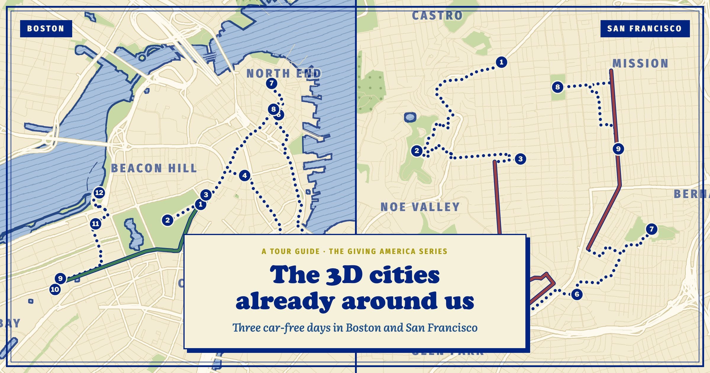
Instead of telling you, though, I’m just going to show you around some of America’s greatest cities, completely car-free. Whether you’re from these cities, or from the suburbs, or from out of the US entirely, I would love for you to experience these cities as I do.
Most of this article, then, is a three day itinerary for Boston and San Francisco, no car needed. These definitely aren’t the only US cities outside of New York (the ultimate 3D city of the US) where it might behoove you to be car-free — Washington, D.C., Philadelphia, and New Orleans come to mind! — but they’re the ones I know best.1
Living without a car makes you interact with the city in its entirety, in a truly three-dimensional way – you get to know your neighbours; you experience the weather; you help tourists find their way. My friends are often amazed about how well I know the ins-and-outs of cities; how I know all of San Francisco’s small parks, and D.C.’s cafes, and Boston’s tourist attractions that most locals have mostly forgotten about, and I tell them that it’s because I don’t have a car. I often walk places, if the walk is less than a couple miles, and I stop at different book stores and viewpoints and groceries; when I take buses and trains, I look out of the windows and note what I would like to see. I take pictures of flowers and trees and interesting houses; I pop into cafes and farmers’ markets and street fairs.
My experience has taught me that, if your city is 3D enough, being reliant on transit isn’t limiting. It’s expansive. An errand that in a car might’ve just been from A to B instead becomes an adventure of A to X to P to Q to B, and I discovered a new neighbourhood and met some shopkeepers and got a pastry and helped someone find their bus connection. It is not easy to be lonely or feel bad for long when you are on the train and bus all the time, seeing all of humanity in our glory and pain; when you are outside in the rain or sun — living.
Pockets of 3D cities exist not only in large cities but in smaller cities and towns – the original article mentions residential college campuses as notable examples. The lovely Salem, Massachusetts, and many other small historic cities in New England have downtowns that predate the car, giving them a 3D feel. Carmel, Indiana is an example of a small city that has made incredible 3D-city type improvements in recent decades. In these places, it’s still hard to live completely without a car, but it’s easy to experience some of the density, diversity, and expansiveness of a 3D city day-to-day.
Living a bit more 3D in a smaller city or town is a worthwhile article that maybe we’ll write soon! In the meantime, I’m focusing on Boston and San Francisco, because those are cities that I know. But if you know a city that you think more people should visit car-free, we’d love to hear from you! On our website, we’ve built this article into an interactive tour guide, where you can see the stops, plan your own trip to Boston or SF, and submit an itinerary for your own city, which we’ll add to the collection.
I’m from outside of Boston and have lived for years in the San Francisco Bay Area. In both places, you might miss a few things by not having a car, but it’ll be more than made up by getting to see the city slowly, in a way that allows you to intentionally interact with people and the environment. I hope that you’ll feel a bit like a local after these trips!
Boston
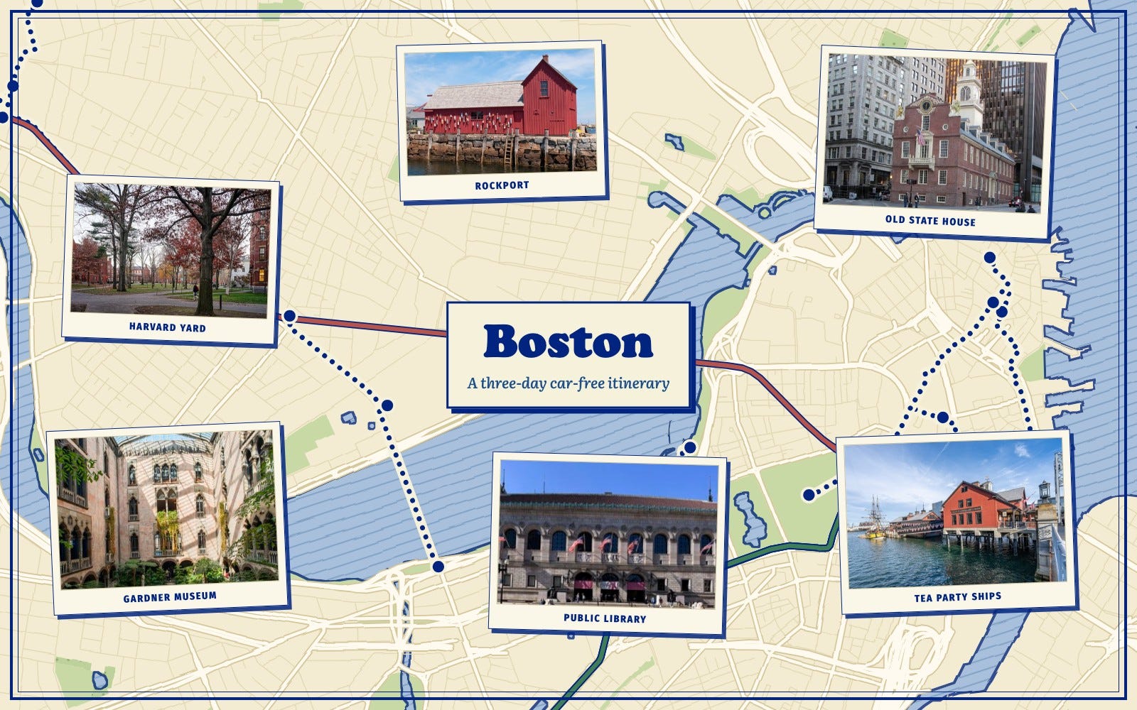
View and follow this as an interactive itinerary on our website!
How to Transit
The MBTA subway, called the T, is the main transit mode in Boston. The most confusing thing about the T is that the Green Line splits off into 4 lines. Thankfully, Boston is a small and very walkable city, so if you’re a tourist going to tourist places and you get on the wrong green line, you’ll probably be mostly fine.
The MBTA also has a variety of buses. Boston unfortunately recently got rid of their trolleybus fleet, so if you want to experience a trolleybus you’ll have to go to San Francisco. Despite this, Boston’s buses are pretty decent by American standards, but you likely won’t have to use them much as a tourist since the T and walking will get you pretty much everywhere on the itinerary.
The MBTA commuter rail takes you out to the suburbs and even to Providence, Rhode Island.
There are also a variety of ferries, some public and some not, that take you to the surrounding islands and seaside towns.
Day 1: The Freedom Trail and environs
I grew up in the area, and in college, I was a tour guide for Japanese students. This is a version of the itinerary I would take the students on – left out, however, is Trader Joe’s, which I learned is really big in Japan and became a staple on our tours.
You’ll probably start at Park Street Station, the oldest subway station in the US (yes, older than New York!). I recommend taking a bit of time in the station itself to look at the old mosaics on the walls and the historical tidbits that are posted around. Half-hidden behind a pillar are the lyrics to M.T.A., a song about a man named Charlie from the early days of the T – when you had to pay a dime to get on and a nickel to get off. Poor Charlie didn’t have the nickel, so he never returned.
“He may ride forever ‘neath the streets of Boston
He’s the man who never returned.”
While other transit systems, like the San Francisco Bay Area BART, have modernized this to swipe in-swipe out, Boston has learned from its sordid past. The T has a flat fare. You can pay it, fittingly, with a CharlieCard.
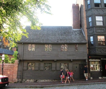
From Park Street, you can take a stroll in the Boston Common (singular) and you can see a lot of historical things on the Freedom Trail, which takes you along the history of the American Revolutionary War and is helpfully marked by red brick. Some highlights include the old statehouse and Faneuil Hall, outside of which the Boston Massacre happened, and Paul Revere’s house – famous for his ride and, to a lesser extent, silversmithing. There are a number of beautiful and historic churches and graveyards in the area, including Park Street Church, the Granary Burying Ground, and the Old North Church.
You can do this all by walking! Heading closer to the water, you can go to the Boston Tea Party Ship and Museum. You can also get tea in their tea room, which I’ve only done once and is pretty fun. There’s plenty of food in this area, and I’d probably recommend skipping Faneuil Hall/Quincy Market and instead heading to the North End and getting some Italian food. People say locals will tell you to avoid Mike’s Pastry, but I actually like it a lot. Modern Pastry across the street is also good; I honestly can’t tell the difference between the cannolis at there and Mike’s; someone will probably revoke my Bostonian card but whatever.
From Park Street, you can take the Green Line – any Green Line! – to Copley Square, the Old South Church, and the Boston Public Library. If you head to the third floor of the library, past the lions, there’s a room of paintings by John Singer Sargent. Copley Square is also right next to Newbury Street, which is Boston’s fancy shopping street. I don’t personally think that it is that great and would skip it to instead walk back to the Common on the nearby historic Beacon Street, which is full of beautiful row houses. From there, you can also take some time to walk along the river on the Esplanade.
Day 2: Museums and Cambridge
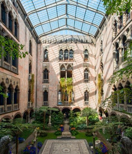
The Museum of Fine Arts is nice and worth a stop if you have some extra time, but my favourite museum in Boston is the Isabella Stewart Gardner Museum, which is right next door, off the Longwood Medical Area T stop on the Green Line E Branch. A large house around a greenhouse-like covered courtyard — flowers bloom even in winter — it was the private collection of a rich woman who loved art, and is also famous for the art theft in the 90s.2 Each room has its own colours and themes, filled with furniture, and contemporary exhibits rotate through the newer part of the house.
You can take the Green Line back to Park Street to switch to the Red Line to go to Cambridge. While you’re there, stop by Chinatown for food. Gene’s Chinese Flatbread Café is a personal favourite of mine.
The Red Line to Alewife will take you to Cambridge to explore some of the most famous colleges in the US. Harvard Square drops you in, unsurprisingly, in the middle of Harvard Square. You can’t miss the statue of John Harvard – I would recommend not touching the statue – and make sure to look at Massachusetts Hall, the oldest dorm on campus, built in 1720, which houses only 14 freshman students. Memorial Church and Annenberg Dining Hall complete the large buildings in Harvard Yard, which is mostly comprised of freshman dorms and classrooms.
The Museum of Natural History is one of my favourite places in the area, with an absolutely beautiful collection of glass flowers made by a father and son for science in the time before computers. You can easily walk from Harvard’s to MIT’s campus, stopping at Central Square on the way. Clover Food Lab, a local chain, has some of my favourite sandwiches using fresh ingredients and was a college go-to. Veggie Galaxy, a greasy diner, is amazing and proves that plant-based food can be very unhealthy. I often stop by Andala café, a cozy spot right near the Central Square T, or Life Alive, another local chain with a lot of vegetarian options. Toscanini’s is my favourite ice cream in Boston, which is saying a lot, because Boston is a great ice cream city.
MIT’s campus is very different from Harvard’s; make sure to see all the modern art and head down the ¼ mile infinite corridor, which ends in a large atrium with a glass ceiling that was covered during WWII to prevent Axis pilots from bombing it. There’s also a fun and free little science museum on campus. To get back into Boston, you can either walk over the bridge – measured in Smoots, a unit of measurement the height of an MIT student in the 50s – or take the Red Line from Kendall Square.
At any point in time, if there’s a Red Sox game – or even if there isn’t! – take the Green Line (B,C, or D) to Kenmore and go to Fenway Park, the second-oldest, and greatest, ballpark in America. Read John Updike’s New Yorker article about Ted Williams on the T.
Day 3: Car-free day trip – the North Shore
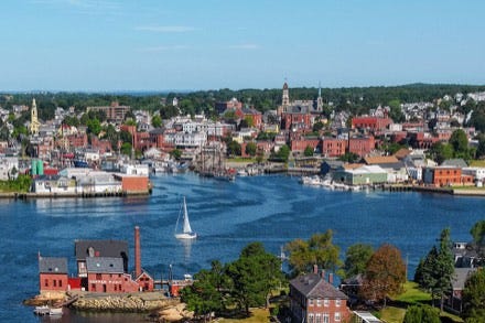
The MBTA commuter rail out of either north or South Station will take you to many beautiful seaside towns. You can get a weekend pass for unlimited rides for only $10, and the trains, while a bit old, are clean and charming. I would recommend taking the Newburyport/Rockport line – my home line! – out of North Station to Salem, which can be a day trip in itself for its history, including the Peabody-Essex maritime-focused history museum, and of course various witch paraphernalia. Goodnight Fatty is a great place for cookies and unique filled bagel things. Take the train further to Gloucester or Rockport for seaside beaches and rocks, old, unique houses, and walkable town centers. Holy Cow in Gloucester is probably my favourite ice cream in the world. There’s also a lot of seafood in the area that I hear is good. Another fun thing about the area is that it shows up in a lot of films, including Manchester by the Sea (mostly filmed in Beverly, another nice commuter rail city) and CODA. Rockport also doubles for Alaska in The Proposal.
San Francisco
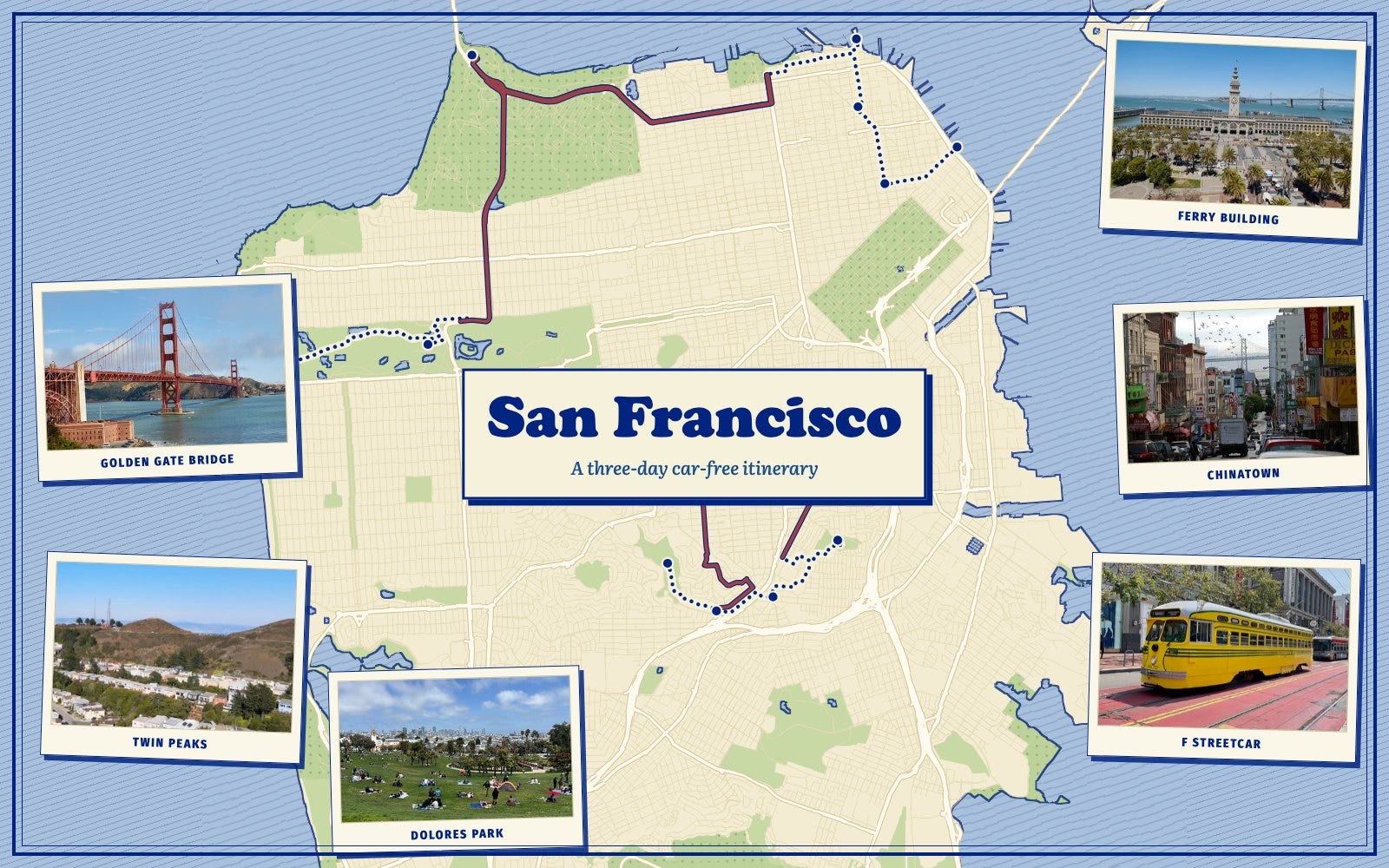
View and follow this as an interactive itinerary on our website!
How to Transit
San Francisco, the city proper, has the second best transit in the US, just after NYC. The city is served by a glorious hodgepodge of heavy rail (BART and Caltrain), light rail (Muni), buses (also Muni) — including the largest fleet of zero-emissions, quiet, pleasant, trolleybuses in the US, cable cars, streetcars, and ferries. This makes getting around San Francisco by transit not only convenient — your car can’t get broken into if you don’t have one! — but also fun in itself. Where else can you take a streetcar line where each individual car is painted to look like different American — and at least one Canadian — streetcars of yore?
Unfortunately, the transit situation rapidly deteriorates as you get out of the city; the rest of the Bay Area is a less glorious hodgepodge of 9 different transit systems, which thankfully have been recently integrated in the Clipper Card system. My biggest tip is to download the Clipper Card in your phone wallet (not the app! I don’t even know what the app does!); you can tap to pay for everything, including the ferries, including the lost little San Jose light rail, and your life will be much easier.
Day 1: The tourist stuff
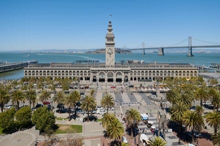
For your first day in San Francisco, I’d recommend a pretty standard tourist loop of Ferry Building → Chinatown → Fisherman’s Wharf → Golden Gate Bridge/Presidio → Golden Gate Park. This is all really easy to do via public transit, and the transit comes often.
The Tourist Stuff in San Francisco is tourist stuff for good reason! I have been to the Golden Gate Bridge probably a hundred times now – when I lived in the city; I would bike over it almost every week to get to Marin County in the north – and it still amazes me every time.
The best way to get from the Ferry Building – home of El Porteño, which has incredible empanadas, and Dandelion Chocolate, a San Francisco staple – to Fisherman’s Wharf is to walk through Chinatown and North Beach, San Francisco’s historically Italian neighborhood. San Francisco’s historic Chinatown is one of the largest in the US, along with New York, and while a lot of Chinese residents have moved to the Richmond and Sunset neighborhoods closer to the beach, historic Chinatown is like nothing else. It’s been inhabited since the 1850s, started mostly by people from Guangdong Province — the ancestors of your correspondent! — who came to build the railroads. As a vegetarian, no one trusts my restaurant recommendations, but if you want to try some great Chinese American vegetarian food, you can head to Enjoy Vegetarian. To learn more about Chinese immigration to the US in the 1800s and early 1900s, a half-day ferry trip to Angel Island, where Chinese and other immigrants were detained and wrote poems on the barracks walls, now preserved in a museum, is well worth your time.
An alternative way to get along the Embarcadero is to the F streetcar line, the aforementioned line where every car is painted to look like another city’s (former) streetcars. For Muni heritage weekend last weekend, there were all sorts of fun streetcars running on the F line, including ones from the first and second batch in 1912 and 1914 — the first batch is as old as Fenway Park! — and a boat streetcar. Another fun fact is that Maya Angelou worked as a streetcar conductor as a teenager.
Fisherman’s Wharf, like Quincy Market, is not a good place to buy anything at, but it’s definitely worth a trip because in what other city are you going to be hanging out with a bunch of sea lions with a beautiful view of hills and Alcatraz and the Golden Gate Bridge? If you want to get food here, there is an In-N-Out burger nearby, and the famous Boudin Bakery — the sourdough here, also, is famous for a reason. I usually get a snack from Cafe de Casa, a large Brazilian cafe, when I am in this area.
From Fisherman’s Wharf, you can take the 28 bus directly to the Golden Gate Bridge. Make sure to sit on the right side for lovely views of the Bay. When you’re done with the Golden Gate Bridge – I have no special tips here, it is incredible! – you can take the 28 further to drop you right outside Golden Gate Park. On the way there, Geary Boulevard is full of great restaurants and bakeries, particularly Chinese and Russian food.
Alternatively, if you really like walking, you can walk a path along the ocean through the Presidio all the way down from the Golden Gate bridge, through Sea Cliff, one of the richest and most picturesque neighborhoods in SF, and head to either Land’s End or Golden Gate Park.
In Golden Gate Park, my favourite thing is the Botanical Garden, which due to San Francisco’s mild climate comprises habitats from all around the world. If you like museums, the de Young Museum and Cal Academy of Sciences are near the entrance to the park. I’d recommend walking all the way to the beach through the park, looking at all the interesting street art. If you’re lucky, you might see some bison or even a dragon.
From Ocean Beach, you can catch the N Judah back to downtown or to a direct BART or Caltrain transfer.
Day 2: The Southern City
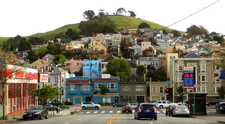
We’re going to start at Twin Peaks, another tourist-thing-that-is-touristy for a reason, but after that we can kind of choose our own adventure in my old haunts, the beautiful and less touristed southern half of San Francisco.
The best way to get to Twin Peaks from downtown is probably on the Muni light rail to the Castro District. After exploring the Castro’s little downtown famous for gay culture, head up 17th street to Clayton and Twin Peaks Boulevard. On your right on 17th Street is the Pink Triangle Memorial, filled with pink quartz and flowers in honour of LGBT Holocaust victims.
Twin Peaks is actually the third (and fourth) largest hill in the city, after Mount Davidson to the south and Mount Sutro to the west, but it provides the best panoramic view of the city. The climb up from the Castro requires some cardio but is relatively – for San Francisco – gradual; the faster route that you can take down to 24th Street is mostly stairs. Since this route is a bit hard to explain, I’d recommend mapping to Vive La Tarte. While the much-lauded Arsicault, with locations in the Richmond and Civic Center, is probably known as the best croissant in the city for a reason, Vive La Tarte’s coconut-chocolate croissant at least rivals it. From a couple blocks from Vive La Tarte – right across the street from my old apartment – you can grab the 35 bus to Glen Park BART station. Possibly the best food in Glen Park is in Canyon Market, a supermarket and deli with fresh, made-to-order, sandwiches and also my favorite brownies ever.
Walk up Chenery Street to Glen Canyon Park, a trail-filled canyon that blooms brilliantly with flowers in April and May. It is one of San Francisco’s hidden gems, and it is easy to forget you’re in the city.
If you’re not yet tired of walking, you can walk about half an hour through the cute – though sometimes hilly – neighborhood of Glen Park to Mission Street in Bernal Heights for pupusas. I always map to Balompié Cafe #3, but there are about 5 different pupuserías in this area, all of them excellent. Nearby, you can walk to Holly Park and the vast Bernal Heights Park with views of the city and the East Bay. If you come during the summer, numerous blackberry bushes line the sides of the park for a good snack.
If you’re tired of walking, you can go back to Glen Park BART and take it one stop to 24th Mission. If you chose to go to Bernal earlier it’s also easy to get down to Mission via the 14 or 14R bus.
As an end to this day of parks, you can check out Dolores Park, a gathering place on sunny days with nice views of downtown. Near the park is the Mission Dolores cemetery, the last remaining cemetery in San Francisco after the others were moved to the nearby town of Colma.
Finish the day with a Mission Burrito, something you can’t leave the city without. El Farolito, which is cash-only, has the best deal in the city. The nearby Papalote has a greater variety of vegetarian options. BART and various buses from 24th Mission will take you anywhere in the city you need to go.
Day 3: Car-free day trip – Oakland and Berkeley
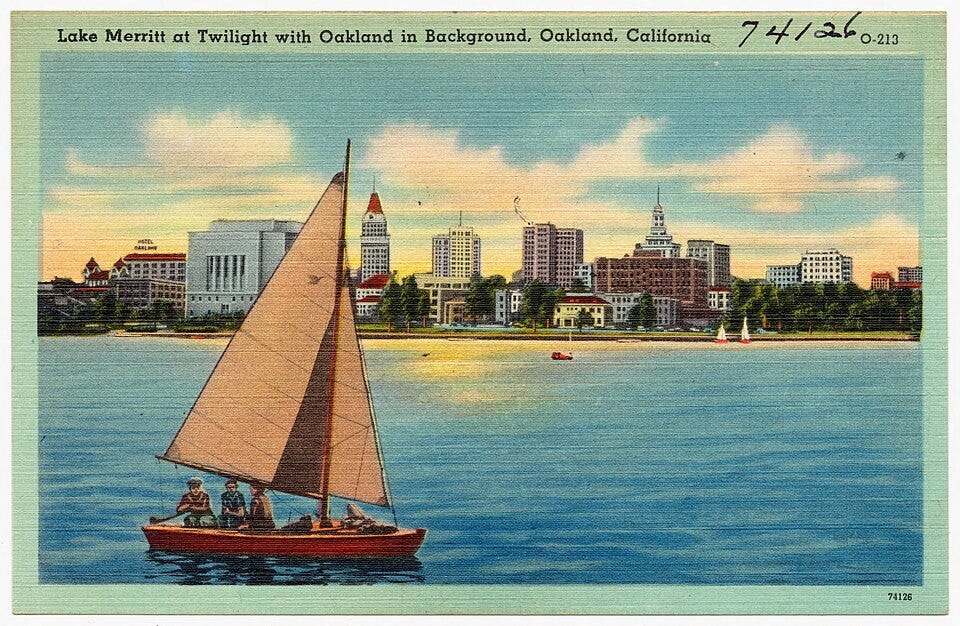
Head to the East Bay! I’m biased because I live here, but Oakland and Berkeley is a great place to spend a day, and the county’s AC transit, while not quite as robust as MUNI, is quite serviceable (I live car-free!). You can hike in the Oakland Hills — the 31 bus from Fruitvale BART has incredible views and brings you straight to a trailhead into a redwood forest — or the Berkeley fire trails: you can walk from the Downtown Berkeley BART, or take the 51B to close to the trails. Both have beautiful views overlooking the city. You can take the 57 bus from MacArthur BART to the Emeryville Marina, or the 51B bus from Downtown Berkeley BART to the Berkeley Marina to enjoy miles of biking or walking along the Bay Trail. If you prefer your water a little more marshy and full of birds, Lake Merritt is a quick walk from 19th St. BART in Oakland.
The food in the East Bay is probably even better than the food in San Francisco. Some Berkeley favourites (vegetarian biased, but this is the place for vegetarian food!) include: Udupi Palace, Café Tibet, and The Butcher’s Son. I also don’t think I’ve ever had a bad ramen or café stop in Berkeley. My favourites in Downtown Oakland include Shan Dong, World Famous HOTBOYS Chicken, Battambang, and Golden Lotus.
If you want to be even more adventurous, you can take the ferry to Marin County, north of San Francisco, actually do the beautiful Dipsea trail car-free. This is a little logistically complicated but well worth it.
With the exception of D.C., which is a quite 3D city that I unfortunately had to cut from this article due to time/length, the other American cities I know best — Chicago, Seattle, and Honolulu — are places I unfortunately cannot with good conscience say you should take a three day trip to without a car. Chicago has quite a decent transit system, but the tourist attractions are spread out and a car makes it easier to get around. Seattle has an excellent bus system and light rail with a great new line, but the most incredible part of Seattle is the surrounding nature, which you mostly (with the exception of Mt. Si and its sister mountains!) need cars to get to. Honolulu also has a new light rail and a decent bus system, but all the best beaches and hikes are not on the light rail, and while I always have wanted to take the bus system around Oahu, it’s not the first thing I’d recommend for a first-time traveler.
This Wikipedia article goes into a deep dive on Boston organized crime and is more interesting than it has any right to be.